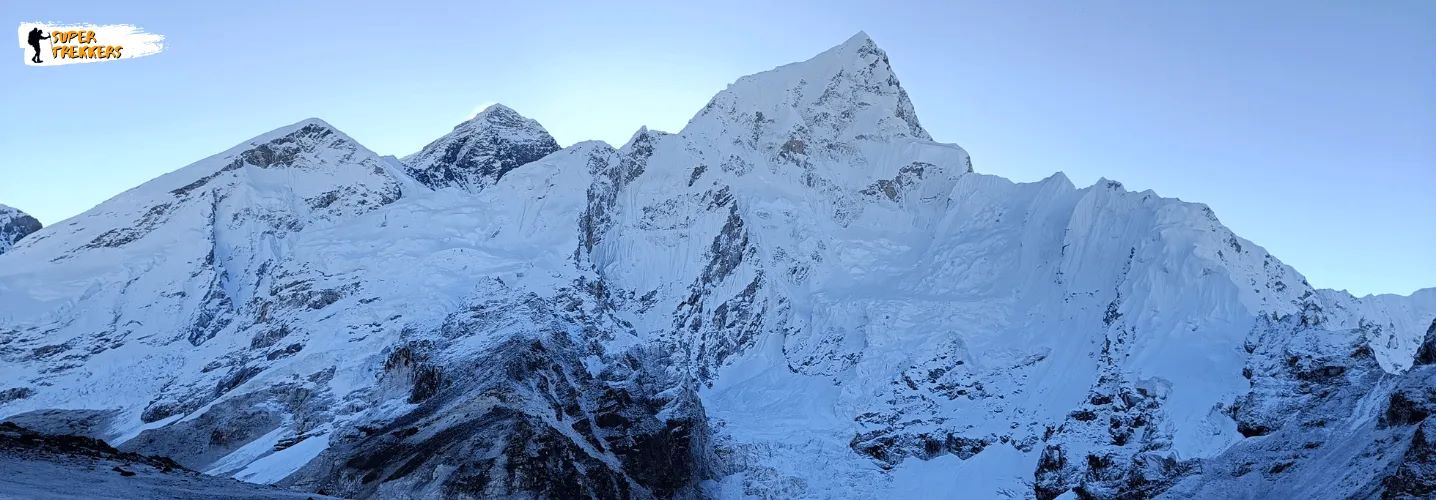
Mount Everest, the Earth’s highest peak at 8,848.86 meters (29,031.7 feet), straddles the border between Nepal and Tibet (China) in the Mahalangur Himal sub-range of the Himalayas. Its precise location at 27°59′17″N latitude and 86°55′31″E longitude places it in Sagarmatha National Park (Nepal) and Tingri County (Tibet). This guide covers everything about Everest’s geography, how to visit, and key facts about its base camps.
Mount Everest, the world’s highest peak, has captivated adventurers and dreamers for decades. Whether you’re planning a trek to Everest Base Camp or simply curious about this iconic mountain, this guide covers everything you need to know about its location, altitude, and more. At Super Trekkers, we’re passionate about helping you explore the wonders of the Himalayas with confidence and excitement. Let’s dive in!

Where Is Mount Everest? Location, Country, Height & Coordinates
Mount Everest is located in the majestic Himalaya mountain range, straddling the border between Nepal and the Tibet Autonomous Region of China. Specifically, it sits on the crest of the Great Himalayas, with its southern slopes in Nepal and northern slopes in Tibet. The mountain’s coordinates are approximately 27.9881° N latitude and 86.9250° E longitude, making it a beacon for mountaineers and trekkers worldwide.
- Coordinates: 27.9881° N, 86.9250° E
- Countries: Nepal (south) and China (north)
- Region: Khumbu, eastern Nepal, and Tingri County, Tibet (China)
- Nearest Major City: Kathmandu (160 Km air distance)
- Border Status: Demarcated by 1961 China-Nepal boundary treaty
🏔️ Mount Everest
The ultimate guide to Earth’s highest peak
📍 Location & Geography
Elevation
8,848.86 m
29,031.7 feet above sea level, according to the joint Nepal–China measurement announced in 2020.
Countries
Nepal & China
The summit sits on the international border between Nepal and the Tibet Autonomous Region of China.
🌐 Approximate Coordinates
27°59'17"N, 86°55'31"E
In Nepal, Everest is within Sagarmatha National Park; the northern side is in Tibet.
🏕️ Base Camps Comparison
| Feature | South Base Camp (Nepal) | North Base Camp (Tibet) |
|---|---|---|
| Elevation | About 5,364 m (17,598 ft) | About 5,150 m (16,900 ft) |
| Access | Multi-day trek from Lukla, commonly around 11–14 days round trip. | Access is generally via road from the Tibet side; current access rules apply. |
| Popular season | Spring (March–May) and autumn (September–November). | Conditions and access vary; confirm the current travel season locally. |
| Permits | National park and local-area permits are generally required. | Travel permits and an authorized itinerary are generally required. |
| Known for | Khumbu Icefall, glacier scenery and views of surrounding peaks. | Views of Everest’s north face and the Rongbuk area. |
📅 Best Times to Visit
☀️ Spring · March–May
A popular trekking season with generally stable pre-monsoon weather.
🍂 Autumn · September–November
Post-monsoon conditions often bring crisp air and clear mountain views.
🌧️ Monsoon · June–August
Rain, cloud and possible trail or transport disruption can affect plans.
❄️ Winter · December–February
Very cold conditions and snow may make trekking more demanding.
✨ Everest Facts
Local names
Sagarmatha and Chomolungma
First confirmed ascent
Edmund Hillary and Tenzing Norgay, 1953
A changing mountain
Tectonic uplift, erosion and earthquakes all affect the landscape.
Classic trek gateway
Lukla is the usual starting point for the Nepal-side trek.
🧭 Getting to Base Camp
From Nepal · South Base Camp
Travel to Kathmandu, continue to Lukla, then trek through the Khumbu region with time for gradual acclimatization.
From Tibet · North Base Camp
Travel arrangements generally route through Lhasa and onward by road. Entry is subject to current permits, access rules and an authorized itinerary.
Before you travel: Access, permits, seasonal conditions and transport arrangements can change. Confirm current requirements with the relevant authorities or a registered local operator.
Mount Everest Is Located in Which Country?
To clarify, Mount Everest is shared by two countries: Nepal and China. The summit lies directly on the border, with Nepal hosting the more popular trekking and climbing routes, particularly via the South Col from Everest Base Camp in Nepal. The northern approach, accessed through Tibet, is another route used by climbers, though it’s less frequented due to permit restrictions and logistics.
For most adventurers, Nepal is the gateway to Everest. The trek to Everest Base Camp starts in Lukla, a small town in Nepal’s Khumbu region, and winds through stunning landscapes, Sherpa villages, and rugged terrain.
Everest Base Camp: Altitude and Elevation
Everest Base Camp is a bucket-list destination for trekkers, offering a chance to stand in the shadow of the world’s tallest mountain without needing to summit it. But how high is Everest Base Camp, and what should you know about its altitude?
Everest Base Camp Height and Elevation
- South Base Camp (Nepal): Located at an altitude of 5,364 meters (17,598 feet) above sea level, this is the more popular base camp for trekkers and climbers. It serves as the staging point for those attempting to summit Everest via the South Col route.
- North Base Camp (Tibet): Situated at 5,150 meters (16,900 feet), this base camp is accessed from the Chinese side and is less commonly visited by trekkers due to accessibility and permit requirements.
Everest Base Camps: South vs North
| Feature | South Base Camp (Nepal) | North Base Camp (Tibet) |
|---|---|---|
| Elevation | 5,364m (17,598ft) | 5,150m (16,900ft) |
| Access | 12-day trek from Lukla | Drive to Rongbuk + short hike |
| Best Season | March-May & Sept-Nov | May-October |
| Permits | Sagarmatha NP permit + TIMS | Tibet Travel Permit |
| View | Khumbu Icefall | North Face panorama |
The Everest Base Camp altitude in Nepal is significant, as it places trekkers in a high-altitude environment where proper acclimatization is critical. At over 17,000 feet, the air is thin, and altitude sickness is a real concern. That’s why Super Trekkers emphasizes gradual ascent, proper hydration, and expert guides to ensure your safety and enjoyment.
Mount Everest: The World’s Tallest Peak
- Elevation: 8,848.86 meters (29,031.7 feet) above sea level
- Location: Border of Nepal and China (Tibet)
- National Park: Sagarmatha National Park (Nepal)
Mount Everest isn’t just the highest point on Earth—it’s a symbol of adventure, resilience, and the spirit of exploration. Whether you’re trekking to Base Camp or just soaking in the mountain’s majesty, Everest offers a life-changing experience.
Quick Reference Table
| Feature | Details |
|---|---|
| Where is Mount Everest? | Border of Nepal and Tibet (China) |
| Mount Everest Coordinates | 27.9881° N, 86.9250° E |
| Country (Best Access) | Nepal |
| Everest Base Camp Altitude | 5,364 meters (17,598 feet) |
| Mount Everest Elevation | 8,848.86 meters (29,031.7 feet) above sea level |
Schedule a FREE Guidance Call with Super Trekkers today!
Why Trek to Everest Base Camp?
Trekking to Everest Base Camp is more than just reaching a destination—it’s a journey through breathtaking landscapes, vibrant Sherpa culture, and personal triumph. Here’s why it’s a must-do:
- Stunning Scenery: From lush valleys to glacier-carved trails, the Khumbu region offers unparalleled views of peaks like Lhotse, Nuptse, and Ama Dablam.
- Cultural Immersion: Stay in traditional teahouses, visit ancient monasteries like Tengboche, and connect with the warm-hearted Sherpa community.
- Personal Achievement: Standing at Everest Base Camp, surrounded by the world’s highest peaks, is a moment you’ll never forget.

How to Reach Mount Everest
From Nepal Side:
- Fly to Lukla (35min from Kathmandu)
- Trek via Namche Bazaar (8-10 days to EBC)
- Required Permits:
- Sagarmatha National Park Entry
- Khumbu Pasang Lhamu Rural Municipality Permit
From Tibet Side:
- Fly to Lhasa (3,650m)
- Drive via Everest Highway (2 days)
- Stop at Rongbuk Monastery (world’s highest)
Best Times to Visit Everest
- Prime Trekking Seasons:
- Spring (March-May): Stable weather, summit attempts visible
- Autumn (Sept-Nov): Clear skies, excellent visibility
- Avoid:
- Monsoon (June-August): Landslide risks
- Winter (Dec-Feb): Extreme cold (-30°C at summit)
Tips for Planning Your Everest Base Camp Trek
- Choose the Right Season: The best times to trek are spring (March-May) and autumn (September-November) for stable weather and clear views.
- Prepare Physically: The trek involves long days of hiking at high altitudes. Cardiovascular training and leg strength exercises are key.
- Pack Smart: Layered clothing, sturdy trekking boots, and a good sleeping bag are essentials. Don’t forget sunscreen and sunglasses for UV protection.
- Acclimatize Properly: Follow a well-planned itinerary with rest days in places like Namche Bazaar to adjust to the altitude.
- Go with Experts: At Super Trekkers, our experienced guides and carefully crafted itineraries ensure a safe and memorable adventure.
Fun Facts About Mount Everest
- Mount Everest stands at 8,848.86 meters (29,031.7 feet), as confirmed by a 2020 survey by Nepal and China.
- Its name honors Sir George Everest, a British surveyor, though locals call it Sagarmatha (Nepal) or Chomolungma (Tibet), meaning “Goddess Mother of the World.”
- The first confirmed summit was by Sir Edmund Hillary and Tenzing Norgay in 1953.
Ready to Trek with Super Trekkers?
Whether you’re dreaming of standing at Everest Base Camp or simply want to learn more about the world’s highest peak, Super Trekkers is here to make your adventure unforgettable. Our expert team offers personalized guidance, top-notch safety measures, and a passion for sharing the magic of the Himalayas.
Ready to take the first step? Contact us today to plan your Mount Everest adventure, and let’s conquer the heights together!
Mount Everest & Everest Base Camp FAQs
Planning a visit to the Everest region? These answers cover Mount Everest, the Nepal-side Everest Base Camp trek, practical preparation and common travel questions.
Frequently Asked Questions About Mount Everest
Where is Mount Everest located?
Mount Everest is in the Himalaya range on the border between Nepal and the Tibet Autonomous Region of China. Its approximate coordinates are 27.9881° N, 86.9250° E. The southern slopes are in Nepal’s Khumbu region; the northern slopes are in Tibet. The popular Nepal-side Everest Base Camp trek starts with a flight to Lukla.
Is Mount Everest in Nepal or China?
The summit lies on the Nepal–China (Tibet) border, so both countries share the mountain. The popular trekking approach is through Nepal’s Khumbu region via Lukla. The northern approach is through Tibet and has separate access and permit requirements.
How tall is Mount Everest in feet and metres?
Mount Everest is 8,848.86 metres (29,031.7 feet) tall, according to the joint Nepal–China announcement in 2020. Some older references give 8,848 metres, based on an earlier measurement.
What is the altitude of Everest Base Camp?
Nepal’s South Base Camp is approximately 5,364 metres (17,598 feet) above sea level. Most trekkers also visit Kala Patthar, a higher viewpoint with expansive views of Everest and surrounding peaks.
What is the best time to visit Everest Base Camp?
Spring (March to May) and autumn (September to November) are the most popular seasons. They generally offer more stable weather, clearer skies and moderate trekking conditions, though weather and visibility can change at any time in the mountains.
How long does the Everest Base Camp trek take?
A typical trek from Lukla to Everest Base Camp and back takes about 11 to 14 days. The exact duration depends on the itinerary, pace, weather and acclimatization days. Allowing time to acclimatize is important at high altitude.
Do I need a guide for the Everest Base Camp trek?
A qualified local guide is strongly recommended, particularly for first-time high-altitude trekkers, because a guide can support navigation, logistics and responses to changing conditions. Trekking rules can change; confirm the current guide requirement for your route with a registered trekking agency or the relevant Nepal authority before departure.
What permits do I need for the Everest Base Camp trek?
Trekkers on the Nepal route generally need a Sagarmatha National Park entry permit and a Khumbu Pasang Lhamu Rural Municipality permit. The TIMS requirement and permit procedures can change, so check the current rules and fees with a registered trekking agency or the relevant local authorities before travel.
Do Indian citizens need a visa for the Everest Base Camp trek?
Indian citizens generally do not need a visa to visit Nepal. You should carry valid identification accepted by the current Nepal entry and trekking-permit rules. Accepted documents and procedures can change, so verify the latest requirements with official Nepal authorities or your trekking agency before travelling.
Is the Everest Base Camp trek difficult?
The trek is generally considered moderate to challenging. It does not involve technical climbing, but high altitude, cold conditions and several hours of walking on many days make it demanding. Build up your fitness beforehand and follow a gradual itinerary with acclimatization time.
What should I pack for Everest Base Camp?
Essentials include layered warm clothing, a down jacket, waterproof outer layers, broken-in waterproof trekking boots, warm hat and gloves, sunscreen, sunglasses, a personal first-aid kit, prescribed medicines and a way to treat drinking water. Adjust your packing list to the season and your itinerary.
Are there places to stay along the Everest Base Camp trail?
Yes. Teahouses and lodges operate in villages along the main trail, providing places to sleep, eat and rest. Facilities and availability vary by village and season, so plan accommodation as part of your itinerary.
Is Mount Everest still growing?
Everest’s height can change through tectonic uplift, erosion and other geological processes. Estimates often describe uplift in the region as a few millimetres per year, but the measured height does not increase at a perfectly constant rate.
Can you see Mount Everest from India?
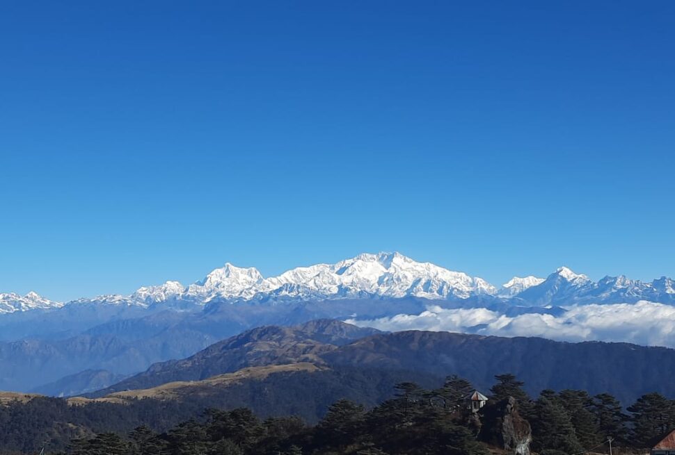
On clear days, distant views of Everest may be possible from Sandakphu on the Singalila Ridge, near the India–Nepal border. Visibility depends on weather, haze and season.
Travel note: Altitudes and general trek information are provided as planning guidance. Permit, visa, identification and guide rules may change; verify current requirements before booking or travelling.