The Buran Ghati Trek is often described as a “Grand Buffet” of India’s greatest Himalayan treks, seamlessly weaving together a variety of stunning landscapes. It provides an adventurous experience in the untouched parts of the Himalayas, offering several experiences in one package. This trek is picture-perfect, boasting flawless scenery, great campsites, and high-altitude adventure
The Buran Ghati Trek is a hidden gem of Himachal Pradesh, weaving through lush meadows, ancient villages, sparkling streams, and finally culminating at the breathtaking Buran Pass (15,000 ft). Known for its dramatic landscapes and thrilling snow wall descent, this trek offers a perfect blend of adventure, beauty, and culture.
Unlike commercialized treks, Buran Ghati retains its raw Himalayan charm. Trekkers experience the contrast of apple orchards in Janglik village, alpine forests of Dayara, and the surreal snow-crossings at the pass. It’s a trek that challenges your limits while rewarding you with unforgettable views.
Quick Facts – Buran Ghati Trek
- Trek Duration: 7-8 Days
- Difficulty: Moderate to Difficult (Rated as a challenging trek)
- Maximum Altitude: 15,000 ft (4,572 m) at Buran Ghati Pass
- Trek Distance: Approximately 50-55 km
- Starting Point: Janglik, Himachal Pradesh
- Ending Point: Barua, Himachal Pradesh
- Best Time to Visit: May–June (snow adventure), September–October (clear skies, golden forests)
- Permits: Required from the Forest Department.
Highlights– Buran Ghati Trek
- Janglik Village: Traditional Himachali wooden houses.
- Dayara Meadows: Vast grasslands ideal for camping.
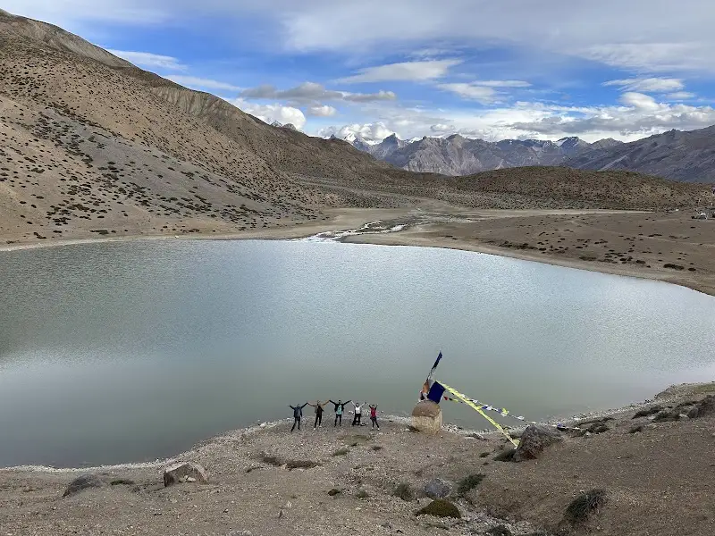
- Chandranahan Lake: Sacred glacial lake surrounded by snowfields.
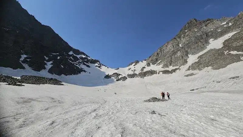
- Buran Pass: 15,000 ft high-altitude thrill with panoramic views.
- Snow Wall Descent: Unique rappel-style adventure.
- Barua Village: Rich in apple orchards and Kinnauri culture.
What is the Detailed Itinerary of the Buran Ghati Trek?
Day 1: Shimla to Janglik (9,200 ft) – Drive through Pabbar Valley, overnight stay.
Day 2: Janglik to Dayara Thach (11,000 ft) – Trek through pine forests & meadows.
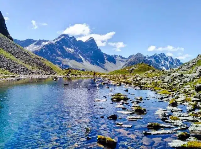
Day 3: Dayara Thach to Litham (11,800 ft) – Stunning views of Gunas Pass & Chandranahan waterfall.
Day 4: Excursion to Chandranahan Lake (13,800 ft) – Sacred alpine lake exploration.
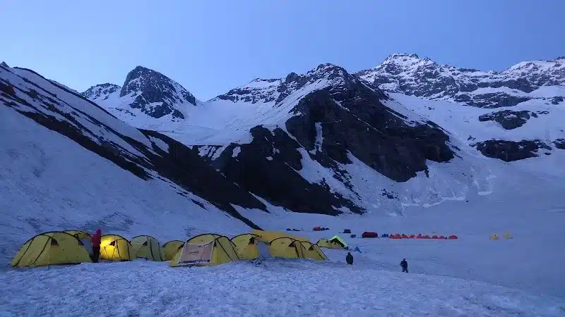
Day 5: Litham to Dhunda (13,500 ft) – Campsite with panoramic snow-capped peaks.
Day 6: Dhunda to River Camp via Buran Ghati (15,000 ft) – Steep climb & thrilling snow-wall rappel.
Day 7: River Camp to Barua (6,300 ft) – Descent through orchards & exit trek.
Day 8: Barua to Shimla – Drive back.
Buran Ghati Trek – Itinerary at a Glance
Buran Ghati Trek – Route Map
Buran Ghati route is a high-altitude crossover trek that links the Pabbar/Dayara side (Himachal) to the Baspa/Kinnaur side, typically starting from Janglik (road head) and finishing at Barua village (or Shimla by road transfer). Key high points include Litham meadows, Chandranahan Lake (optional/acclimatisation side-trip), Dhunda, and the Buran Ghati (Buran Pass) at about ~15,000 ft (≈4,572 m).
Janglik → Dayara → Litham → Chandranahan (side trip) → Dhunda → Buran Pass → River Camp → Barua → Shimla
Buran Ghati Trek Altitude Profile
This altitude graph shows gradual ascent from Janglik to Litham followed by a steep climb to Buran Pass (4,572 m) and rapid descent to Barua
Buran Ghati Trek – Altitude Profile
8-Day Crossover Trek · Max Altitude 4,572 m · Moderate to Difficult · Super Trekkers
Best Time to Visit the Buran Ghati Trek
The Buran Ghati Trek offers two distinct, incredible seasons for a truly memorable experience. Your choice depends on whether you seek the ultimate snow-trekking challenge or prefer clear skies and lush green landscapes.
The Spring/Early Summer (Mid-May to Late June) is the most popular time for this trek. During this period, the higher campsites and the pass itself are covered in vast snowfields. The highlight of this season is the thrilling, rope-assisted rappel down a steep ice wall on the other side of the pass—a truly unique and exhilarating experience. The weather is transitioning from winter to summer, so be prepared for cold nights and sub-zero temperatures at higher altitudes.
Alternatively, the Autumn season (September to Mid-October) provides a different but equally stunning perspective. After the monsoon, the skies are generally clear, offering spectacular, unobstructed views of the surrounding mountains. The meadows are lush and vibrant, and while the snow has melted from the pass, the descent is still a challenging but manageable trek over a rocky trail. This season is perfect for those who prioritize panoramic views and a serene, less-crowded trail.
How to Reach the Buran Ghati Trek Starting Point
The Buran Ghati trek starts from the village of Janglik in the Pabbar Valley, and the journey to get there is a mini-adventure in itself.
Getting to Shimla Your journey to the base camp will begin from Shimla, which is well-connected to major cities.
- By Air: The nearest airport is Jubbarhatti Airport (Shimla), but it has limited connectivity. A better option is Chandigarh International Airport (IXC), from where you can take a bus or a cab to Shimla.
- By Train: The nearest major railway station is Chandigarh (CDG) or Kalka (KLK). From Kalka, you can take the famous Toy Train to Shimla, a UNESCO World Heritage site, for a scenic journey.
- By Road: A large number of buses, both private and government-run (HRTC), ply daily from Delhi, Chandigarh, and other major North Indian cities to Shimla. The journey takes around 8-10 hours from Delhi.
Buran Ghati Trek Package Cost
The cost of a guided Buran Ghati trek with a professional and reliable outfitter like Super Trekkers for your safety, comfort, and peace of mind. Our packages are designed to be all-inclusive, transparent, and provide the best value for your money.
The typical cost for the 8-day Buran Ghati trek ranges from ₹17,000 to ₹22,000 per person, plus GST. The exact price may vary depending on the season, the number of people in the group, and the specific services included. This is a general estimate; for the most accurate and up-to-date pricing, please refer to our official booking page.
How Should Trekkers Prepare for the Buran Ghati Trek?
- Fitness Training:
- Jog 5 km in under 35 minutes.
- Strength training (squats, lunges, planks).
- Stair climbing with a backpack.
- Essential Gear Checklist:
- Trekking shoes (ankle support, waterproof).
- 50–60L backpack with rain cover.
- Warm clothing layers + down jacket.
- Trekking poles, gloves, sunglasses.
- Headlamp, personal first-aid kit.
- Permits: Himachal Forest Department permits (arranged by Super Trekkers).
- Insurance: Always recommended for high-altitude trekking.
What Safety Precautions are Necessary on the Buran Ghati Trek?
- Acclimatize gradually to avoid AMS (Altitude Mountain Sickness).
- Stay hydrated (minimum 3 liters/day).
- Avoid monsoon season – trails are slippery.
- Trek in groups, avoid solo attempts.
- Carry ORS, Diamox (consult doctor), and a basic medical kit.
- Trust experienced trek leaders for snow crossings.
FAQs:
Where is Buran Ghati located?
Buran Ghati Pass is in the Pabbar valley, Himachal Pradesh, connecting Shimla to Kinnaur district.
How difficult is the Buran Ghati Trek?
It’s moderate to difficult, suitable for trekkers with prior experience or good physical fitness.
What is the altitude of Buran Ghati Pass?
The highest point is around 4,600–4,725 m (15,000+ ft).
What is the best season for the trek?
Late spring (May–June) and autumn (September–October) are ideal.
How long does the trek take?
Standard guided treks are 7 days, including travel from Shimla.
Are guided treks safer?
Yes, especially for technical sections. Guides offer support, gear, navigation, and first aid.
Can first-time trekkers join?
Yes, but fitness preparation is essential; prior acclimatization advised.
What is the cost and what’s included?
Packages range from Rs. 13,900 to Rs. 19,999 with camping, meals, guides, and logistics included.
What gear should trekkers bring?
Sturdy backpack, hiking shoes, warm clothes, rain protection, gloves, water bottle, snacks, sun protection.
What is unique about Chandranahan Lake?
It’s a sacred glacial lake, considered the origin of the Pabbar River and revered by locals.
What’s the highlight of the trek?
The vertical snow wall at Buran Ghati, which often requires rappelling or sliding down for the descent.
How do trekkers reach Janglik?
Scenic drive from Shimla via Rohru, Khadapathar, and Chirgaon; last ATM and mobile point at Rohru.
Is offloading available for backpacks?
Yes, typically Rs. 500/day for offloading (max weight 10 kg).
Are permits or ID proofs needed?
Yes, always carry government ID; operators help with permissions.
Any cultural experiences on the route?
Yes—homestays, village walks, and local cuisine can often be arranged.
How can emergencies be handled?
Qualified trek leaders, medical kits, oxygen cylinders, and contingency plans are standard in guided treks.
What mobile networks work en route?
Coverage till Rohru; beyond that, satellite/walkie communication is used for safety.
What food is provided?
Nutritious vegetarian meals (sometimes eggs); hot meals at camps.
Environmental advice?
Carry trash out, avoid single-use plastics, respect local flora and fauna